
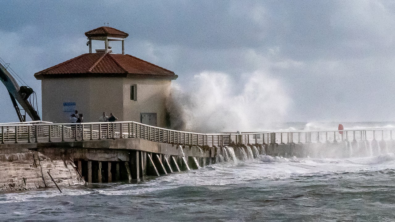
Throughout the last week of October, intense tides caused record-high water levels across the Southern California coast. Ocean water flooded the Redondo Beach boardwalk. Tide levels in San Diego topped 8 feet above baseline. Water level readings were among the highest in more than a century, according to the National Oceanic and Atmospheric Administration.
This year’s record-hot Super El Niño helped push those water levels to the extreme. But El Niño also combined with a natural phenomenon called king tides. More king tides later this year are expected to bring even more intense, damaging flooding to the coast.
And working underneath both of these events is climate change, which has caused sea level rise and intense marine heat waves.
All these factors are compounding and overlapping, experts say, in a way that will likely make this a dangerous winter for those along the coast. Here’s why that’s happening.
What are king tides?
King tides aren’t a new phenomenon. “We’re used to these every year,” says Marc Alessi, a climate scientist with the Union of Concerned Scientists.
The term refers to exceptionally high tides, which bring water levels above what an average high tide would be. They occur normally along the coastline, often causing flooding.
King tides form because of the way the sun, moon, and Earth align, and when the moon is at its closest to the Earth. That certain alignment of the three heightens the gravitational pull on the ocean. As gravity pulls more on that water, it raises tidal heights.
Because king tides are affected by that celestial alignment, they can be predicted. The next major round of king tides is forecast for just a few weeks from now: November 22 to 28, around Thanksgiving, and then again December 22 to 26, around Christmas.
King tides can occur on both the Atlantic and Pacific coasts. Florida also experienced king tides in October, which flooded multiple areas. In Fort Lauderdale, the city’s chief resilience officer, Nancy Gassman, told reporters that at the end of October, water levels rose about 6 inches higher than during previous king tides.
How does El Niño affect king tides?
Though king tides can impact both U.S. seacoasts, El Niño doesn’t affect these coasts in the same way.
For California, El Niño causes another phenomenon called Kelvin waves, because of the way El Niño changes wind patterns.
During a non-El Niño year, winds blow from east to west over the Pacific Ocean, essentially “pushing water up against Indonesia,” Alessi says. But during an El Niño year, those winds weaken. Without the winds pushing the water, it “sloshes” back toward the other side of the Pacific.
“Imagine a bathtub, and you’re sloshing a big volume of water to the other side,” Alessi says. “But in this case, it’s the Pacific Ocean.”
Kelvin waves are very long, but they move slowly. They also travel underneath the water, which means they don’t break on the shore. When a Kelvin wave hits South America, it splits, and one part travels up toward the California coast. This raises sea levels because it brings a “bulge” of warm water.
One of the main characteristics of an El Niño is above-average sea surface temperatures in the Pacific. But separate from El Niño, the Pacific has been dealing with an intense marine heat wave off the California coast. Kelvin waves then bring even more warm water to that area.
And because warm water expands, that raises sea levels even more—6 to 10 inches on top of king tides, and on top of sea-level rise, Alessi says. This is another example of how climate change and El Niño are combining to turbocharge their impacts.
Florida doesn’t experience Kelvin waves. But El Niños still impact the Southeast, primarily by bringing more rain throughout the winter. More precipitation means a higher risk of flooding across the state.
The impact of climate change
All these climate events are happening on top of fossil fuel-driven climate change, which has already added about 8 inches to the average sea level height over the last 100 years.
“Climate change is this accelerator on top,” Alessi says. “It’s not just the king tides. We have climate change fueling these marine heat waves, which are expanding the water off the coast. We have it influencing the El Niño and the Pacific Ocean, which would not have been as strong without the background warming already existing there. All of these factors combining are contributing to these record high tidal levels.”
This year’s El Niño is already the strongest on record—and it hasn’t even reached its peak yet. Forecasters expect El Niños to reach their maximum intensity from November to about January, before weakening into the spring.
Whether climate change has amped up this El Niño’s strength, or to what extent, is something scientists are still researching. But they do know that El Niño amplifies the impacts of climate change.
El Niño essentially lies on top of a world that is already warmer because of our burning of fossil fuels. That gives us a glimpse of what a future with even more intense climate change could look like.
Or as António Guterres, the United Nations secretary-general, put it: “El Niño conditions will pour fuel on the fire of a warming world.”
We are “just getting into the thick” of this El Niño, Alessi says, and already, California has declared a state of emergency, intense rain in the Four Corners region of the Southwest has caused extreme flooding, and the Pacific had one of its busiest hurricane seasons.
With the king tides expected in November and December, on top of El Niño, it could cause “record high tidal heights this winter,” Alessi adds.
“This is a wakeup call,” he says. “The fact is, we live in a fundamentally different climate system than 100, even just 50 years ago. Every part of our climate system is impacted by fossil fuel-driven climate change in some way. We need to stop the burning of fossil fuels.”