

When Pokémon Go was released, it appeared to be a harmless game encouraging people to go outside and explore, yet beneath that surface was a far more sophisticated system that directed human movement into very specific locations where data was needed most, turning millions of users into mobile data collectors. The placement of Pokémon, Gyms, and PokéStops was not random, but concentrated around landmarks, businesses, and dense urban corridors, meaning players were repeatedly funneled into high-value mapping zones, often returning to the same locations over and over again, capturing them from multiple angles, at different times of day, and under varying conditions, which is exactly how high-quality spatial datasets are built.
For many reading this, particularly those who never played the game, it is important to understand what this actually looked like in practice, because this was not some passive background process, it required people to physically walk through neighborhoods, parks, shopping districts, and even residential areas while holding up their phones, actively scanning their surroundings to “catch” virtual creatures that did not exist. The game encouraged users to point their cameras at real-world objects, move around them, and interact with the environment. The system was capturing detailed imagery not just of public landmarks but also of surrounding areas, including streets, entryways, and private homes, all embedded in what appeared to be a simple entertainment experience.
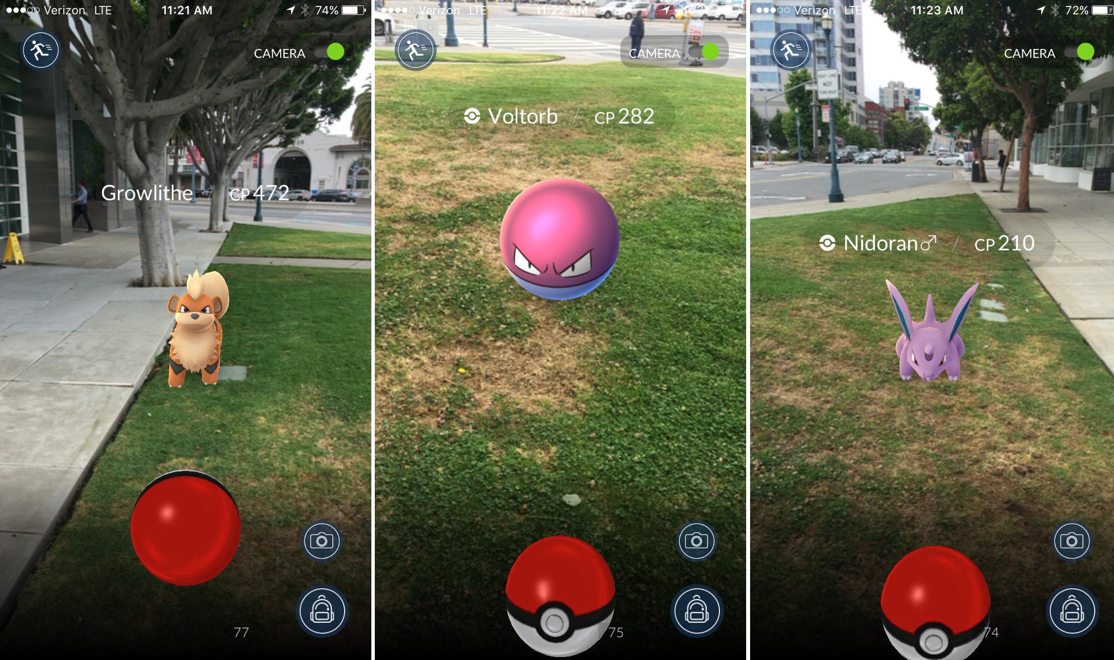
The scale of what was collected is staggering and now confirmed by the company itself, with Niantic stating that its system has been built on roughly 30 billion real-world images gathered through its augmented reality games, each tied to precise data such as GPS location, camera angle, and device movement. These images are not random snapshots but structured data points, captured repeatedly at more than a million key locations globally, many of which were photographed from multiple perspectives and under varying environmental conditions, enabling the system to build highly accurate three-dimensional models of real-world environments.
Niantic has been explicit about the purpose of this dataset, explaining that it is building what it calls a “Large Geospatial Model,” a system designed to allow machines to understand and navigate the real world. One executive stated, “We look at the player data as very high-quality ground training data,” making clear that the information gathered through gameplay is being used to train artificial intelligence systems.
The game was an immediate success as the Pokemon franchise has lasted throughout generations with both children and adults eagerly playing along. The reach of this operation is global, spanning nearly every major city on the planet and millions of individual locations, with new data continuing to be added at a rate of roughly one million scans per week. This was not a static dataset but a constantly evolving, real-time mapping system built through ongoing participation.
Companies like Google spent years deploying fleets of Street View vehicles equipped with specialized cameras to capture imagery from roads and highways, a process that was expensive, slow, and inherently limited to where vehicles could physically travel. Pokémon Go achieved something far more granular by using millions of people on foot, inside buildings, parks, and residential neighborhoods, collecting data from angles and locations that vehicles could never reach. Niantic even charged users to unlock advanced gaming features, profiting while secretly using the system to create a on-the-ground map of the world.

What Niantic created was effectively a pedestrian-level mapping system that surpassed traditional methods in density and perspective, because every image was captured at human height, from within the environment itself, rather than from a passing vehicle, and when those billions of images are layered together, the result is a dataset that can pinpoint a user’s position to within centimeters based on surrounding visual cues, a level of precision that conventional GPS systems struggle to achieve in dense urban environments.
The game itself was the mechanism that made this possible, because it incentivized behavior that would otherwise require massive investment, placing rare Pokémon and rewards in specific areas so that players would voluntarily travel to those locations, linger there, and capture detailed visual data, effectively turning curiosity and competition into a distributed workforce that operated at global scale.
This was perhaps the largest data collection operation in history. Participation was voluntary, and the implications were never fully understood; the result is a system that has quietly built a high-resolution, continuously updated model of the physical world using data supplied by hundreds of millions of users in every corner of the globe.
Niantic has outlined multiple industries where this data will be deployed, including logistics, warehousing, construction, and spatial planning, all of which rely on understanding physical environments in real time. The reality is that this data is now being commercialized, integrated into robotics, licensed for enterprise use, and positioned as the backbone for future AI systems that interact with the real world, meaning what began as a game has evolved into one of the most valuable spatial datasets ever created.
Remember: if something is free, YOU are the product.